Texas Transportation Institute logo

National Deployment Strategy for Truck Stop Electrification

project by the Texas Transportation Institute
with funding provided by the United States Environmental Protection Agency

How to Use the Interactive Map

Return to Home

Figure 1: The Map's Initial View

Interactive map screenshot showing the entire continental United States.

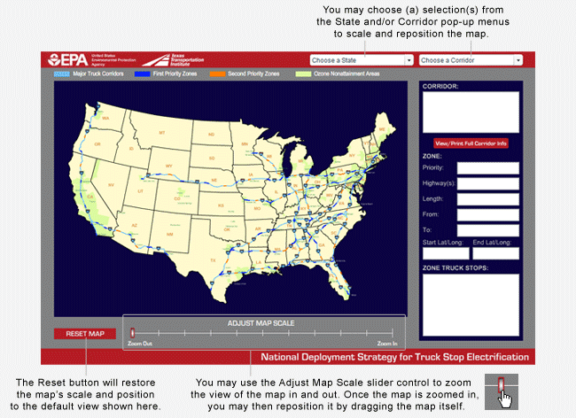
Figure 2: Adjusted View of the Map

Interactive map screenshot showing a full view of the state of Indiana with neighboring state partially visible.

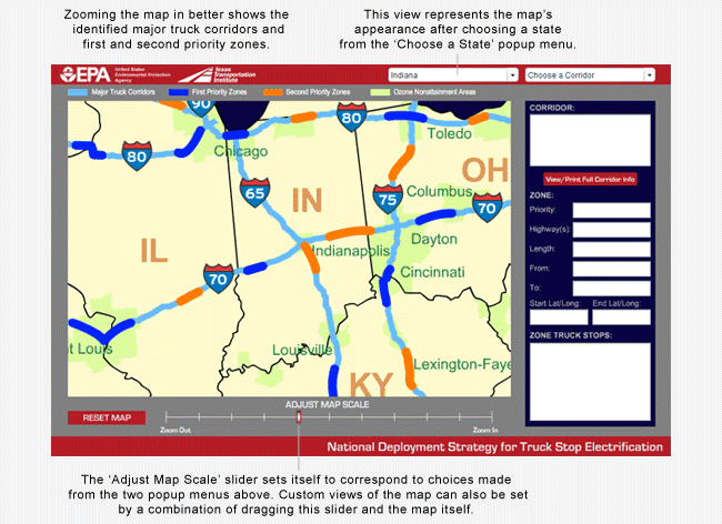
Figure 3: The Cursor Over a Corridor and Zone

Interactive map screenshot showing the cursor positioned over a corridor and zone near Chicago; all other corridors appear dimmed.

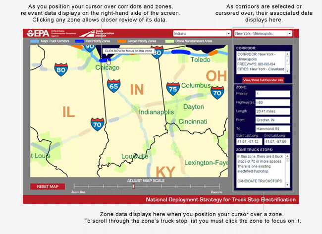
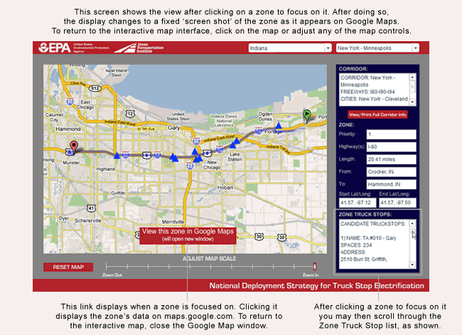
Figure 4: Focus on an Individual Priority Zone

Interactive map screenshot showing a view of Google Maps revealing the zone clicked in figure 3.